NATIONAL PROFILE
INTRODUCTION
General Overview of the Indigenous Populations of Mexico
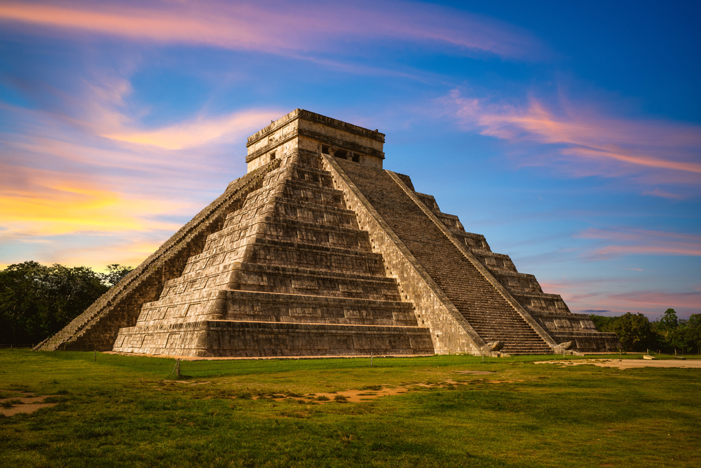
1. The discovery of the Americas in the sixteenth century revealed to the European invaders two great civilizations: the Inca in the Southern Hemisphere, and the Mesoamerican in the Northern Hemisphere. The latter was characterized, until colonization began, by all the elements commonly associated with “advanced civilizations.” These included a great concentration of sedentary populations; sophisticated political organization of hierarchical states; intensive agriculture; monumental constructions including temples, and civil structures; a great tradition of sculpture and pictorial art; hieroglyphic writing; the use of sophisticated calendars, and; mathematical computation. It also included a variety of social classes, centralized religious systems with priestly castes.
2. To the north of this Mesoamerican civilization, was the zone of hunters and gatherers, known as arid-America. In this zone, with desert ecology, its inhabitants successfully adapted to the limited resource base and harsh environment through a primarily nomadic economy, with a low demographic density and limited sedentarized settlements. In contrast to the Mesoamerican civilizations, they had a relatively simple social and political structure; a low level of technological development and simple knowledge of architecture as well as relatively unsophisticated artistic, religious and intellectual expressions.
3. Mesoamerica is comprised of a series of areas or regions which illustrate the specific characteristics of its unique cultures which still persist today, such as a Mayan area, Huasteca area, Zapotec, Mixtec areas, etc. All of them form a part of a single unique Mesoamerican cultural area, and all have contributed, over the long span of the formation of this culture over five thousand years, to the ancient history of contemporary Mexico.
4. The heterogeneity of peoples and cultural diversity of Mexico are testimony of the resilience and continuity of the Mesoamerican civilization. It is expressed through its 56 ethnic groups spread over 2 million square kilometers of the national territory and constitute at least 10 percent of the nation’s nearly 95 million inhabitants.
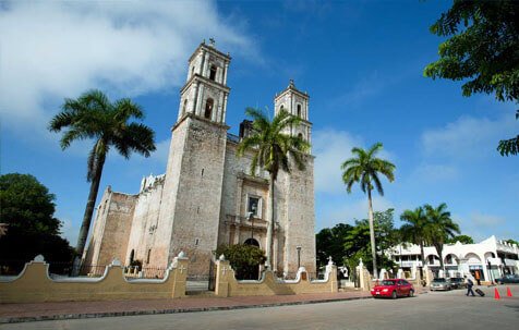
5. The sites and ceremonial areas, remnants of the original cultures, are still significant to the contemporary indigenous groups and constitute important settlements wherein the inhabitants gather to carry out their economic, cultural, social, religious and political activities. Some examples of these settlements are contemporary Tenochtitlan in what is today Mexico City, Cholula in the state of Puebla, Palenque in Chiapas, and Monte Alban in Oaxaca.
The term Mesoamerica was first used by Paul Kirchoffto describe the area of Middle America characterized as a region of high
civilizations. Middle America is the geographical term used to describe the region that includes Mexico and Central America.
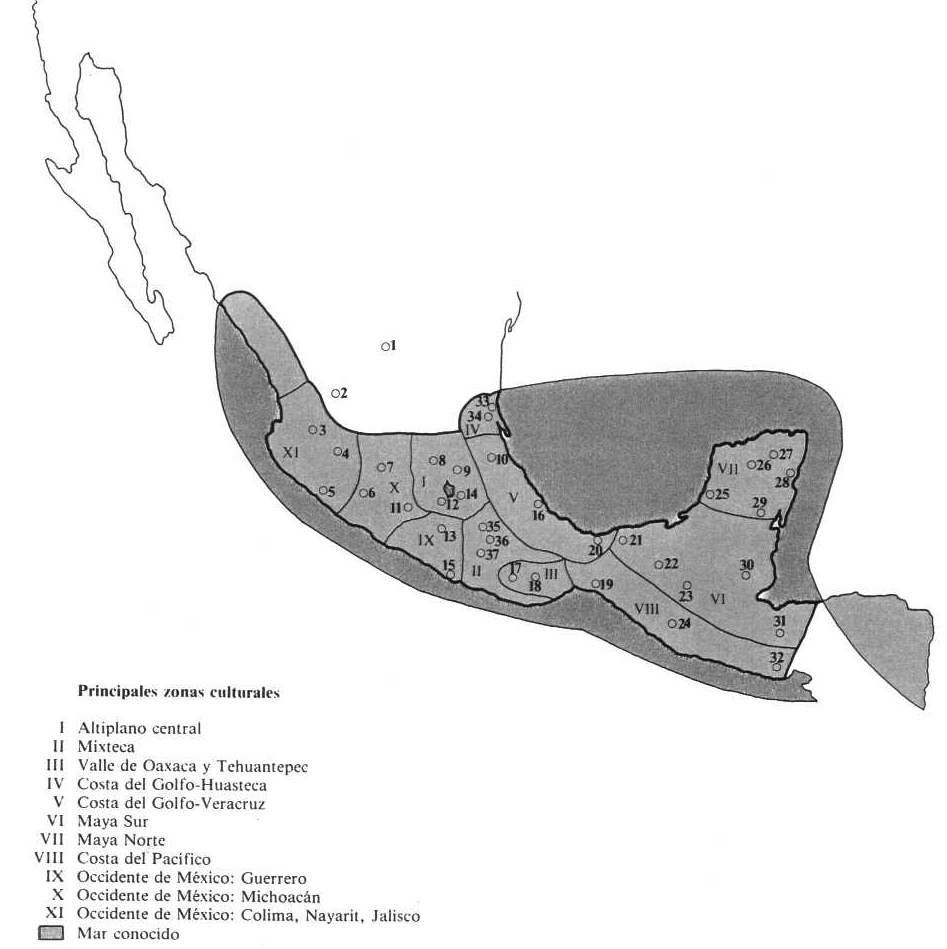
|
|
| 3. Ixtlán | 4. Zacoalco |
| 5. Colima | 6. Apatzingán |
| 7. Tzintzuntan | 8. Tula |
| 9. Teotihuacán | 10. Tajín |
| 11. Huetamo | 12. Xochicalco |
| 13. Iguala | 14. Cholula |
| 15. Acapulco | 16. Zempoala |
| 17. Monte Albán | 18. Mitla |
| 19. Tonalá | 20. La Venta |
| 21. Comalcalco | 22. Palenque |
| 23. Bonampak | 24. Izapa |
| 25. Champotón | 26. Uxmal |
| 27. Chichén-Itzá | 28. Tulúm |
| 29. Xpuhil | 30. Lubantúm |
| 31. Copán | 32. Usulutan |
| 33. Tampico | 34. Pánuco |
| 35. Tehuacán | 36. Teotitlán |
| 37. Coixtlahuaca |
Carta Básica: MESOAMERICA. Según Paul Kirchhoff
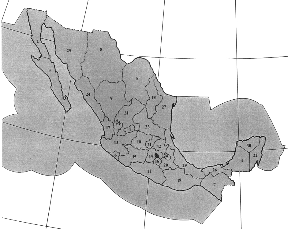
STATES:
1. Aguascalientes 2. Baja California Norte (officially divided fromthe southern part of the state classified as a territory according to the Official Diary of the State February 7, 1931. Subsequently declared a State according to the Official Diary November 21, 1952). 3. Baja California Sur (Divided from the northern portion of the state according to the Official Diary of the State February 7,1931. Subsequently declared a State according to the Official Diary October 8, 1974) 4. Campeche 5. Coahuila 6. Colima 7. Chiapas 8. Chihuahua 9. Durango 10. Guanajuato 11. Guerrero 12. Hidalgo 13. Jalisco 14. México 15. Michoacán 16. Morelos 17. Nayarit 18. Nuevo León 19. Oaxaca 20. Puebla 21. Querétaro 22. Quintana Roo 23. San Luis Potosí 24. Sinaloa 25. Sonora 26. Tabasco 27. Tamaulipas 28. Tlaxcala 29. Veracruz 30. Yucatán 31. Zacatecas 32. Distrito Federal.
EXCLUSIVE ECONOMIC ZONE
Mexico includes a territory formed of 239 islands, 23 keys and 20 reefs. This zone extends 200 nautical miles from the coast.The objective of this zone is to increase Mexico’s jurisdiction over these zones, to avoid excessive or abusive marine resource exploitation, curb and curtail pollution and avoid the use of this zone for military purposes.
Carta Básica: “ESTADOS UNIDOS MEXICANOS CARTA GEOGRÁFICA.” 1980. Dirección General de Geografía del Territorio Nacional, Secretaría de Programación y Presupuesto. Atlas Nacional del Medio Físico.
Instituto de Ecologica, UNAM